
Golden Horn Bay
Golden Horn Bay in Istanbul, Turkey - historic inlet and waterfronts
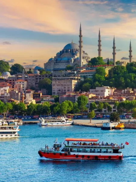
The Golden Horn Bay is located in the European part of Istanbul and connects to the Bosphorus near the Karakoy district. This long curved inlet cuts deeply into the land and separates Istanbul’s historic center from the neighborhoods north of the bay. It has always been an important natural harbor for the city thanks to its protected waters and convenient access to maritime routes.
The Golden Horn is about 7.5 km long. The Alibeykoy and Kagithane streams flow into its western part. Since ancient times, the shores of the bay were used for anchorage, trade, and crafts, and during the Byzantine and Ottoman periods there were piers, shipyards, warehouses, and residential quarters here. Over time, the coastal areas changed, but the bay itself retained its importance as a key part of the city’s structure.
Today, the Golden Horn is of interest to tourists primarily as part of Istanbul’s historic landscape. Its shores offer views of old neighborhoods, mosques, bridges, and the hills on the European side of the city. Along the bay there are promenades, parks, residential districts, and well-known urban areas connected with the history of Constantinople and the Ottoman Empire.
Several bridges cross the bay, including the Galata Bridge, Ataturk Bridge, Halic Bridge, and the Golden Horn Metro Bridge. The name is usually associated either with the shape of the inlet, resembling a horn, or with the golden reflections on the water at sunset, although the exact origin of this toponym has not been reliably established. For travelers, it is a convenient landmark and one of the key waterscapes in central Istanbul.
Golden Horn Bay on the map
Golden Horn Bay - routes, bridges, and waterfront districts
Waterfronts, ferries, and bridges reveal changes in the urban environment and routes for walking.

Historic harbor between the Old City and Galata
The best way to get to know the Golden Horn is during a walk along its shores or while crossing one of its bridges. From the Galata Bridge, you can clearly see the place where the bay meets the Bosphorus, and as you move farther inland, calmer stretches of water, city embankments, and districts long associated with trade, shipping, and crafts come into view.
For visitors, the bay is interesting not as a single viewpoint, but as an entire urban area with different routes. Here you can walk along the embankments, look at the silhouette of the historic peninsula, observe the movement of ferries and city transport, and also see how the development changes from lively central neighborhoods to quieter sections farther west. The contrast between old religious and public buildings and modern urban infrastructure is especially noticeable.
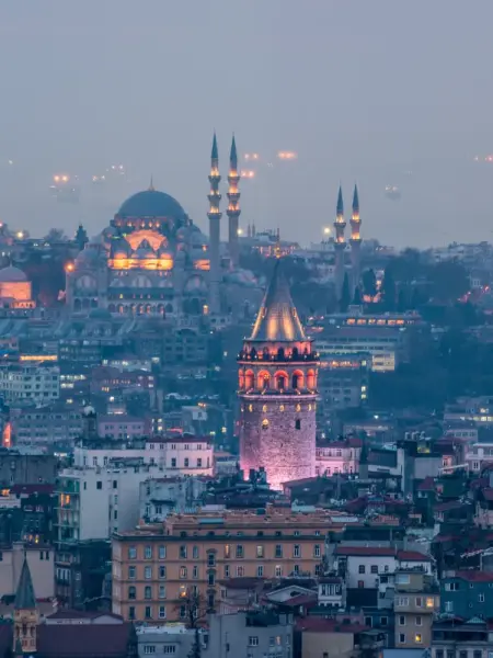
Near the Golden Horn are the Galata Tower, the Balat district, the Fener quarter, the Eyup Sultan Mosque, and Pierre Loti Hill, from where the bay can be clearly seen from above. For the trip, it is convenient to use the tram, metro, bus, or ferries in central Istanbul, depending on which section of the shore you are heading to.
If you want to see the bay from the water, it is worth choosing a short trip on a city boat or ferry along the Halic, as the Golden Horn is often called in Turkey. Such a route allows you to view the bridges, waterfront districts, and the relief of the European part of Istanbul from a different angle. The waterfront sections in the Eminonu, Fener, Balat, and Eyup districts are also suitable for a leisurely walk.
Best tours and travel experiences across the continent


Photos of Golden Horn Bay
Guided tours, popular attractions, and top-rated hotels across the continent