
Sea of Marmara
Sea of Marmara off the shores of Istanbul, Turkey
The Sea of Marmara is an inland sea of Turkey between the European and Asian parts of the country. It connects the Black Sea and the Aegean Sea through the Bosporus and the Dardanelles, so its coasts and straits have long been of great importance for navigation. For tourists in Istanbul, the Sea of Marmara is not only a geographical landmark, but also an important part of the city's landscape.
The history of the region is closely connected with the sea: trade and military routes linking the Black Sea region, Istanbul, and the Mediterranean passed through it. Istanbul, the largest city in Turkey, is located on the northeastern shore, where sea routes still remain a visible part of urban life today. Because of this, the Sea of Marmara is perceived not separately from the city, but as its natural continuation.
The coastline of the sea is diverse: there are open stretches of coast, urban waterfronts, island areas, and calmer bays. Marmara Island and the Princes' Islands, popular for short trips from Istanbul, are located in its waters. For travelers, interest in the Sea of Marmara is usually connected with boat trips, views from the waterfronts, and the opportunity to see Istanbul from the water.
Although the sea is less well known to tourists than the coasts of the Aegean and Mediterranean seas, it is important for understanding the geography and character of Istanbul. Here it is especially clear how a major metropolis, busy shipping, and island districts with a calmer rhythm exist side by side. Visiting the waterfronts and taking a trip on the water help reveal the city and its surroundings from another perspective.
Sea of Marmara on the map
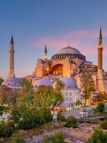
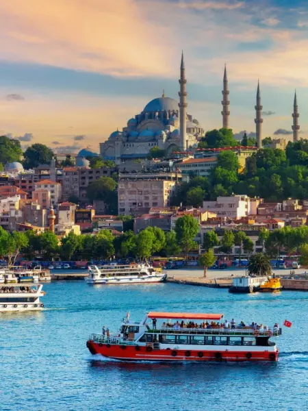
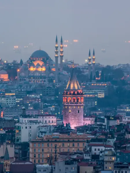
Panoramas and waterfronts of the Sea of Marmara in the Istanbul area
Walks and ferries offer a different perspective on the city landscape.

Straits, islands, and sea views along the shores of Istanbul
In the Istanbul area, the Sea of Marmara is revealed first of all from the waterfronts, port districts, and the decks of city ferries. From here, you can observe the movement of passenger vessels, cargo ships, and private boats, as well as see how the city skyline changes from the historic peninsula to the Asian shore. During trips on the water, the sea's connection with the Bosporus and Istanbul's role as a major maritime hub are especially evident.
One of the easiest ways to get acquainted with the waters is to take a ferry to the Princes' Islands. Such trips allow you to see open stretches of the sea, coastal neighborhoods, and island scenery without having to travel far from the city. On the shore in Istanbul itself, tourists more often choose walks along the waterfronts, stops at viewpoints, and cafés overlooking the water.
The Sea of Marmara is interesting within Istanbul not for beach holidays, but precisely for its combination of urban environment and maritime space. Weather and water conditions can noticeably affect visibility and the nature of outings, while heavy shipping makes some sections of the coast better suited for sightseeing than for swimming. Nearby are the Bosporus, the historic quarters of Sultanahmet, the waterfronts of the Kadikoy district, and the piers from which boats depart for the islands.
You can reach the shore of the Sea of Marmara in Istanbul by tram, metro, bus, or ferry, depending on which part of the coast you want to see. For trips to the islands, it is most convenient to use regular city ferries.
Best tours and travel experiences across the continent

Photos of the Sea of Marmara
Guided tours, popular attractions, and top-rated hotels across the continent