
Bosphorus Strait
Bosphorus Strait in Istanbul, Turkey - geography and shores
The Bosphorus is a narrow sea strait that runs through Istanbul and divides the city into its European and Asian parts. It connects the Black Sea with the Sea of Marmara and remains an important international shipping route. For tourists, it is not only a geographical boundary between two parts of the world, but also one of the city's main panoramas, through which it is easy to understand the layout and scale of Istanbul.
The strait stretches for about 30 km. Its width changes noticeably: in some places the shores come close to each other, while in others wider expanses of water open up. Along the Bosphorus shores, historic districts, Ottoman-era palaces, old fortifications, mosques, piers, residential neighborhoods, and modern transport structures alternate. The contrast between the grand waterfront development and the everyday life of the waterside districts is especially striking.
The Bosphorus is interesting not only for its views, but also for its structure. A two-layer current system operates here: surface waters flow from the Black Sea toward the Sea of Marmara, while deep waters move in the opposite direction. The European and Asian shores are connected by bridges, and the Marmaray and Eurasia tunnels run beneath the strait, allowing the Bosphorus to remain an important part of the city's transport system.
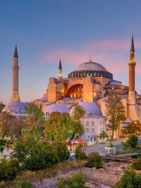
For travelers, the Bosphorus is usually associated with ferry rides, trips along the waterfronts, and visits to coastal districts. From the water, the Rumelihisari and Anadoluhisari fortresses, Dolmabahce Palace, the Beylerbeyi Pavilion, and many other landmarks are clearly visible. A trip along the strait helps reveal Istanbul from a different angle - as a great city that grew around a natural sea route.
Bosphorus Strait on the map
Walks and districts along the Bosphorus Strait
From the water, you can see the city's layout and its different coastal districts.

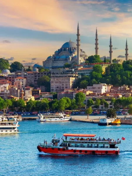
Panoramas of palaces, fortresses, and bridges from the water
One of the most convenient ways to explore the Bosphorus is by ferry ride. During short urban crossings and longer routes, you can observe the changing coastal landscapes: central waterfronts, old wooden yali mansions, fishing areas, piers, and large bridges. From the water, the contours of the shores and the arrangement of districts, which often appear fragmented from the street, are easy to perceive.
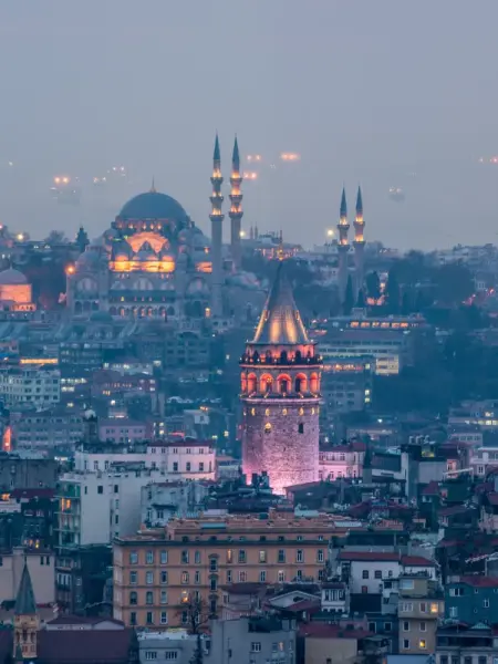
On the European shore, attention is usually drawn to Dolmabahce Palace, the neighborhoods of Besiktas and Ortakoy, and Rumelihisari Fortress. On the Asian side, visitors often look at the Uskudar district, Beylerbeyi Palace, the waterfronts of Kuzguncuk, and Anadoluhisari Fortress. The impression of the strait also changes at different times of day: in the morning, urban transport life is more noticeable here, while by evening the silhouettes of mosques, palaces, and bridges stand out more clearly.
The Bosphorus is also well suited for walks along the shore. The waterfronts in Ortakoy, Bebek, Arnavutkoy, Uskudar, and Kadikoy are popular, where you can watch ship traffic, transfer to ferries, and make stops in coastal districts. Near the southern part of the strait are Istanbul's historic center, the Golden Horn bay, Galata Tower, and the Egyptian Bazaar.
The easiest way to reach the Bosphorus is by city ferries, metro, tram, and buses - the choice depends on which section of the shore you are heading to. For a first walk, many travelers choose the piers of Eminonu, Kabatas, Besiktas, Uskudar, or Kadikoy.
Best tours and travel experiences across the continent


Photos of the Bosphorus
Guided tours, popular attractions, and top-rated hotels across the continent