
Meskendir Valley
Meskendir Valley in Goreme, Cappadocia, Turkey
Meskendir Valley is located near the center of Goreme in Cappadocia and is part of the protected area of Goreme National Park and the Rock Sites of Cappadocia, included on the UNESCO World Heritage List. It is one of the region’s hiking valleys, connecting the surroundings of Goreme with the Rose and Red Valleys and continuing toward Cavusin.
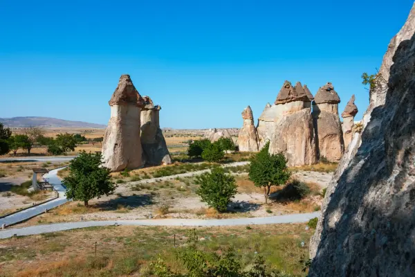
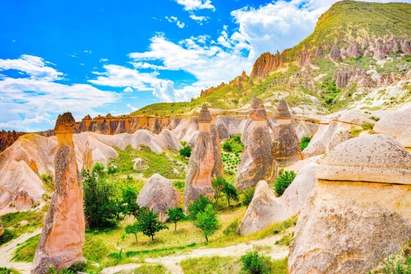
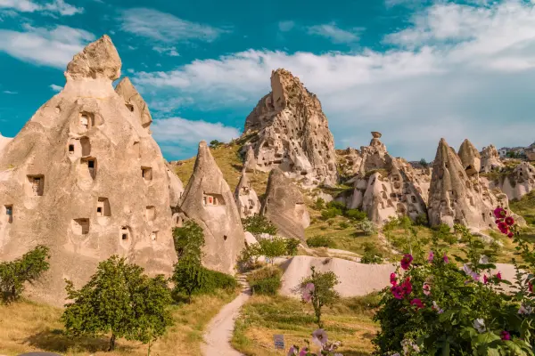
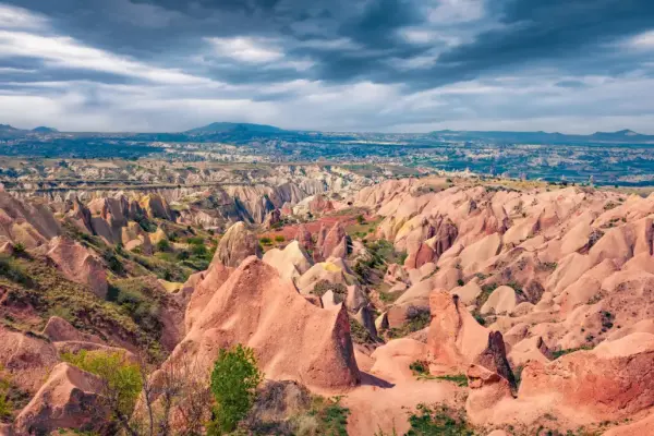
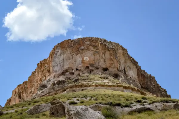
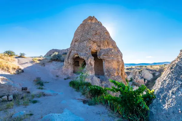
The valley’s landscape is typical of central Cappadocia: soft volcanic tuff has been eroded by wind and water over thousands of years, creating narrow passages, undulating slopes, small tunnels, carved steps, and natural niches. Along the way, you can see dovecotes and rock-cut spaces associated with the daily life of local residents in past centuries. In some places, small rock-cut churches with fragments of frescoes have also survived.
Meskendir is primarily of interest as an easy route for getting acquainted with the natural terrain and rock monuments without a long ascent. The main section of the valley is usually completed in about 1–1.5 hours if walked without long stops and without continuing into neighboring valleys. After rain, wet and slippery sections may appear on the valley floor, so in such weather it is more convenient and safer to choose the higher trails along the slopes.
For tourists, it is a convenient place to experience Cappadocia’s characteristic landscape on foot and combine the walk with visits to neighboring valleys. Meskendir is often included in routes from Goreme to viewpoints, rock churches, and the historic part of Cavusin, so it is well suited to those who want to spend a few hours outside the village while remaining close to the main tourist areas.
Meskendir Valley on the map
Cappadocia, Goreme: Valleys and deserts
Pasabag "Monks Valley", Devrent Imagination Valley, Pigeon Valley, Rose Valley
Meskendir Valley between Goreme and Cavusin
A short hiking trail through tuff slopes and historic rock-cut recesses.

Narrow hiking valley with rock passages and dovecotes
The trail in Meskendir Valley runs between pale tuff walls, noticeably narrows in places, and follows uneven ground with small changes in elevation. Along the route, there are steps carved into the rock, short passages through the rocks, and sections where it is easy to see how erosion shaped Cappadocia’s soft terrain. This path is suitable for a light walk, but it requires comfortable shoes with non-slip soles.
During the walk, it is worth paying attention to the small dovecotes, carved spaces, and traces of old utility structures on the slopes. These elements are a reminder that Cappadocia’s valleys were long used not only as natural passages between settlements, but also as part of rural daily life. In some rock niches and churches, you can notice remains of frescoes, but surfaces should not be touched and unstable cavities should not be entered.
The route is easy to combine with a continuation into the Rose and Red Valleys, as well as with an exit to Cavusin, where rock houses and historic buildings are located. The best time for a walk is in dry weather in the morning or toward evening, when walking is easier and the views of the slopes are more striking.
The start of the trail is usually reached on foot from the center of Goreme, since the entrances to the valley are located not far from the village and are connected to other popular routes in the region. If a long hike through several valleys is planned, it is worth bringing water, sun protection, and checking trail conditions in advance after rain.
Best tours and travel experiences across the continent


Photos of Meskendir
Guided tours, popular attractions, and top-rated hotels across the continent