
Cappadocia Valley
Cappadocia Valley in Central Anatolia, Turkey - routes and attractions
Cappadocia Valley is not a single separate valley, but an extensive system of gorges, plateaus, and rock formations in central Turkey. For tourists, this is primarily the area around Goreme, Uchisar, Urgup, Avanos, and neighboring settlements, where the most famous viewpoints, hiking routes, and sections with distinctive volcanic terrain are concentrated.
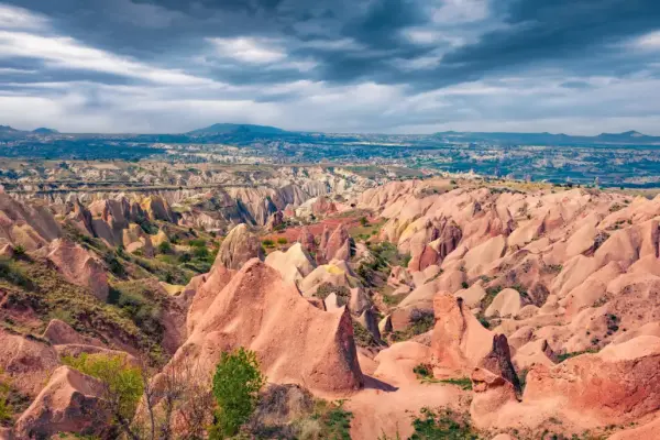
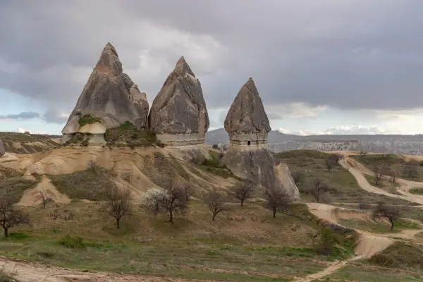
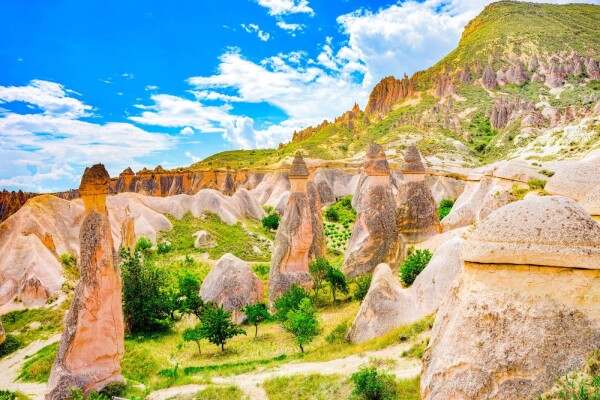
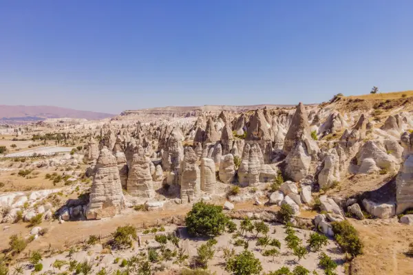
The modern landscape of Cappadocia was formed from layers of tuff and ignimbrite that appeared after the ancient eruptions of Mount Erciyes, Hasan, and Golludag. Later, water, wind, and seasonal temperature changes gradually eroded the soft rock, creating cones, pillars, narrow ravines, and rock outcrops known as "fairy chimneys." It is this geology that makes the area easily recognizable and clearly distinguishes it from other regions of Turkey.
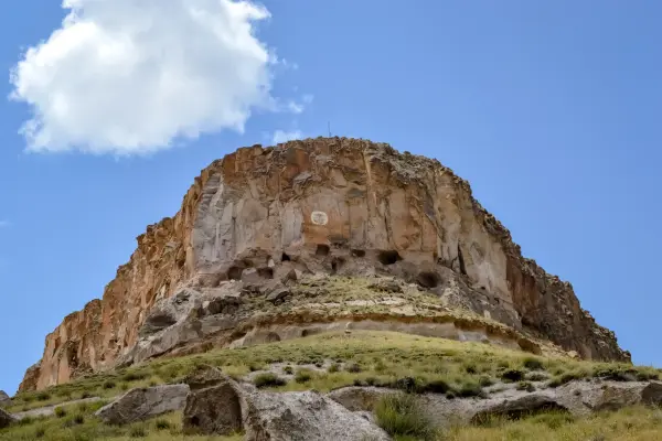
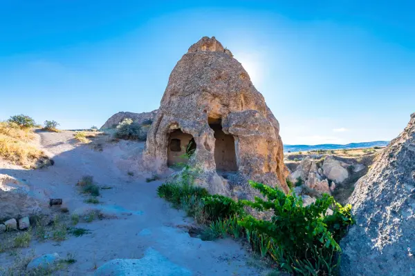
The soft rock allowed people for centuries to carve dwellings, utility chambers, churches, and monastic complexes into the cliffs. In a number of rock-cut churches, frescoes from the Byzantine period have been preserved, and the most famous monuments can be seen in the Goreme and Zelve open-air museums. Goreme National Park and the Rock Sites of Cappadocia have been included in the UNESCO World Heritage List since 1985.
People come here for walks through the valleys, views from scenic lookouts, and hot air balloon flights, which usually take place at sunrise in suitable weather. Some routes are freely accessible, while entry to protected and museum areas is generally paid. Spring and autumn are the most comfortable seasons for hiking, when temperatures are usually milder than in summer.
Cappadocia Valley on the map
Cappadocia: Valleys and deserts
Rose Valley, Soganli Valley, Sword Valley, Devrent Imagination Valley
Exploring the trails and historical monuments of Cappadocia Valley
The routes combine natural formations and the ruins of ancient settlements.

Rock trails, viewpoints, and churches in a volcanic landscape
In the different valleys of Cappadocia, the routes differ noticeably from one another. People most often visit Love Valley and Red Valley for open panoramas and unusual rock formations, Rose Valley for walks among undulating tuff slopes, and Pigeon Valley for views of cliffs carved with dovecotes. On some sections, the trails are exposed to direct sun, so water, a hat, and comfortable shoes with non-slip soles are useful for a walk.
In many places, you can see rooms carved into the rock, small chapels, old utility niches, and tunnels. In protected complexes, there are churches with remains of wall paintings, but such areas usually have restrictions on touching the walls and using flash photography. Some trails have rocky descents and ascents, so not all routes are equally convenient for children, strollers, or visitors with limited mobility.
At sunrise, many people come to the viewpoints to see the rising hot air balloons and the wide panorama of the valleys. For a calmer introduction to the area, daytime hiking routes between Goreme, Uchisar, and the neighboring valleys are well suited. Nearby are also the Goreme Open-Air Museum, the Uchisar rock fortress, and the Pasabag Valley with especially striking stone pillars.
The main entrances and viewpoints are usually reached from Goreme or Uchisar on foot, by taxi, by car, or as part of a local tour. If you are traveling by public transport, it is more convenient to first get to Goreme and then start the routes through the nearest valleys from there.
Best tours and travel experiences across the continent


Photos of Cappadocia
Guided tours, popular attractions, and top-rated hotels across the continent